Post your home for sale
Sign up or Log in
English
-
en
English
-
En
ภาษาไทย
-
Th
Deutsch
-
De
Русский
-
Ru
简体中文
-
Zh
THB - ฿
Buy
Thailand Property For Sale
Condos
Houses
Villas
Land Plots
Townhouses
Penthouses
Apartments
Hotels & Resorts
Whole buildings
Shophouses
Offices
Warehouses & Factories
Retail spaces
Bars
Thailand Real Estate
Commercial Real Estate
Investment Real Estate
Luxury Real Estate
Affordable Real Estate
Overview
Projects
See Newest Listings
Why Buy with KaiBaanThai
Rent
Thailand Property For Rent
Condos
Houses
Apartments
Villas
Townhouses
Offices
Penthouses
Warehouses & Factories
Shophouses
Whole buildings
Retail spaces
Hotels & Resorts
Restaurants
Bars
Thailand Market Overview
Commercial Real Estate
Luxury Real Estate
Affordable Real Estate
See Newest Rentals
List your Rental
Sell
Thailand
Post a Property for Sale
How Much Is My Home Worth?
Why Sell with KaiBaanThai
Partner Agent Program
Projects
Project Directory
Bangkok
Samut Prakan
Pathum Thani
Nonthaburi
Pattaya
Hua Hin
Nakhon Si Thammarat
Koh Samui
Phuket
Krabi
Udon Thani
Chiang Mai
Advice
Post your home for sale
+
My Account
Sign up or Log in
Settings
Language
en
English
-
En
ภาษาไทย
-
Th
Deutsch
-
De
Русский
-
Ru
简体中文
-
Zh
Price display
THB
Menu
Buy
Thailand Property For Sale
Condos
Houses
Villas
Land Plots
Townhouses
Penthouses
Apartments
Hotels & Resorts
Whole buildings
Shophouses
Offices
Warehouses & Factories
Retail spaces
Bars
Thailand Real Estate
Commercial Real Estate
Investment Real Estate
Luxury Real Estate
Affordable Real Estate
Overview
Projects
See Newest Listings
Why Buy with KaiBaanThai
Rent
Thailand Property For Rent
Condos
Houses
Apartments
Villas
Townhouses
Offices
Penthouses
Warehouses & Factories
Shophouses
Whole buildings
Retail spaces
Hotels & Resorts
Restaurants
Bars
Thailand Market Overview
Commercial Real Estate
Luxury Real Estate
Affordable Real Estate
See Newest Rentals
List your Rental
Sell
Thailand
Post a Property for Sale
How Much Is My Home Worth?
Why Sell with KaiBaanThai
Partner Agent Program
Projects
Project Directory
Bangkok
Samut Prakan
Pathum Thani
Nonthaburi
Pattaya
Hua Hin
Nakhon Si Thammarat
Koh Samui
Phuket
Krabi
Udon Thani
Chiang Mai
Advice
Contact
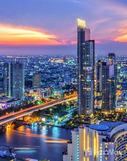
Find your happy
Search properties for sale and to rent in Thailand
Buy
Rent
Purpose
Buy
Rent
Sell
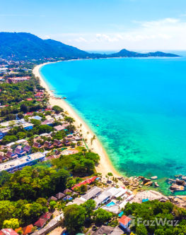
See what’s available in the most popular cities of Thailand
Filter by popular amenities like pets allowed, access to BTS/MRT & private pool
Looking for property in
Bangkok
Looking for property in
Samut Prakan
Looking for property in
Pathum Thani
Looking for property in
Nonthaburi
Looking for property in
Pattaya
Looking for property in
Hua Hin
Looking for property in
Nakhon Si Thammarat
Looking for property in
Koh Samui
Looking for property in
Phuket
Looking for property in
Krabi
Looking for property in
Udon Thani
Looking for property in
Chiang Mai
Properties that were recently reduced in price
Find the must-sell properties at the best prices
Favorite
Compare
฿4,800,000
฿4,900,000
2
1
35.56 SqM
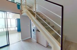
Condo
Metro Sky Prachachuen
Wong Sawang, Bang Sue, Bangkok, Thailand
Favorite
Compare
฿2,130,350
฿2,284,100
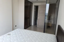
Studio
1
24.60 SqM
Condo
Dolce Lasalle
Bang Na, Bang Na, Bangkok, Thailand
Favorite
Compare
฿2,875,000
฿4,770,000
1
1
28.75 SqM
Condo
777 Beach Condo
Mai Khao, Thalang, Phuket, Thailand
Favorite
Compare
4% Rental Yield
฿11,500,000
฿11,845,000
1
1
53 SqM
Condo
The Room Sukhumvit 38
Phra Khanong, Khlong Toei, Bangkok, Thailand
Favorite
Compare
฿1,562,900
฿1,709,000
1
1
29.74 SqM
Condo
Be Condo Paholyothin
Khlong Nueng, Khlong Luang, Pathum Thani, Thailand
Favorite
Compare
฿3,400,000
฿3,500,000
1
1
28 SqM
Condo
Metro Luxe Ratchada
Din Daeng, Din Daeng, Bangkok, Thailand
Favorite
Compare
฿4,040,000
฿4,935,000
1
1
27.62 SqM
Condo
Blue Sukhumvit 89
Bang Chak, Phra Khanong, Bangkok, Thailand
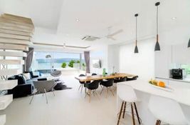
Hot real estate deals in Thailand
Compare thousands of real estate deals on KaiBaanThai
Favorite
Compare
฿4,200,000
1
1
90 SqM
Condo
Khanom Beach Residence
Khanom, Khanom, Nakhon Si Thammarat, Thailand
Favorite
Compare
฿3,000,000
1
1
31 SqM
Condo
Zenith Place Sukhumvit 42
Phra Khanong, Khlong Toei, Bangkok, Thailand
Favorite
Compare
7% Rental Yield
฿6,500,000
2
2
188 SqM
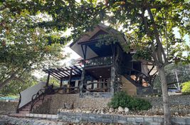
House
Single House for Sale/Rent next to Hin Ngam Beach
Sichon, Sichon, Nakhon Si Thammarat, Thailand
Favorite
Compare
฿7,500,000
1
2
88 SqM
Condo
Baan Sathorn Chaophraya
Khlong Ton Sai, Khlong San, Bangkok, Thailand
Favorite
Compare
5% Rental Yield
฿12,500,000
1
1
107 SqM
Condo
Sansuri
Choeng Thale, Thalang, Phuket, Thailand
Favorite
Compare
฿10,500,000
2
2
89 SqM
Condo
Baan Siri 31
Khlong Toei Nuea, Watthana, Bangkok, Thailand
Favorite
Compare
4% Rental Yield
฿18,900,000
2
2.5
320 SqM
Villa
Luxury Pool Villa By Villa Rawai
Rawai, Phuket Town, Phuket, Thailand
Favorite
Compare
฿2,880,000
4
3
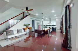
200 SqM
House
Baan Phattharasap
Khu Khot, Lam Luk Ka, Pathum Thani, Thailand
Deals in newly constructed projects
Find the latest off plan developments, Thailand wide
Rawai Grand House
From ฿28,000,000
Rawai, Phuket Town, Phuket
Prasertsuk Village
From ฿2,500,000
Dao Rueang, Mueang Saraburi, Saraburi
Lovely Home
From ฿1,300,000
Hua Ro, Mueang Phitsanulok, Phitsanulok
Diamond Condominium Bang Tao
From ฿4,190,000 - ฿31,300,000
▲ 8%
overpriced
Choeng Thale, Thalang, Phuket
5% Guaranteed Return for 5 Years
Baan Klang Muang 5
From ฿2,990,000
Na Di, Mueang Udon Thani, Udon Thani
Baan Saeng Tawan Phase 5
From ฿1,290,000
Tha Pha, Ban Pong, Ratchaburi
X10 Condo
From ฿1,250,000
Nai Mueang, Mueang Khon Kaen, Khon Kaen
Sin Arom Yen City
From ฿2,200,000
Noen Phra, Mueang Rayong, Rayong
Rise Rama 9
From ฿1,900,000 - ฿8,980,000
▼ -6%
underpriced
Bang Kapi, Huai Khwang, Bangkok
Niche Mono Rama 9
From ฿2,560,000 - ฿5,980,000
▲ 11.5%
overpriced
Bang Kapi, Huai Khwang, Bangkok
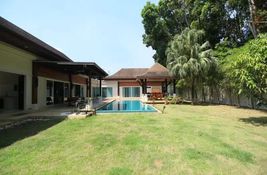
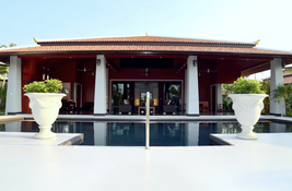
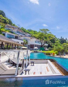
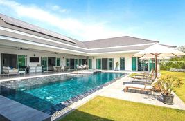
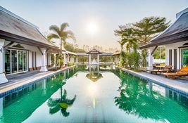
Luxury Houses in Thailand
You can see some KaiBaanThai luxury properties in Thailand
Favorite
Compare
4% Rental Yield
฿49,500,000
฿55,000,000
3
5
375.58 SqM
Condo
Le Raffine Jambunuda Sukhumvit 31
Khlong Tan Nuea, Watthana, Bangkok, Thailand
Favorite
Compare
฿24,900,000
4
4.5
420 SqM
Villa
4 Bedrooms Pool Villa for Sale Near UWC International School
Thep Krasattri, Thalang, Phuket, Thailand
Favorite
Compare
฿27,500,000
4
5
440 SqM
Villa
Exquisite Villa Living at Small Paradise Gold House for Sale
Huai Yai, Pattaya, Chon Buri, Thailand
Favorite
Compare
฿23,500,000
4
4.5
324 SqM
Villa
Sunset Cove Private Residences
Bo Phut, Koh Samui, Surat Thani, Thailand
Favorite
Compare
฿25,000,000
3
3
200 SqM
House
Thai Style House in Saraphi
Khua Mung, Saraphi, Chiang Mai, Thailand
Favorite
Compare
฿21,000,000
4
4
282 SqM
Penthouse
Malibu Kao Tao
Nong Kae, Hua Hin, Prachuap Khiri Khan, Thailand
Favorite
Compare
฿200,000,000
51
51
155 SqM
Hotel
ขายโรงแรมใจกลางเมืองพัทยา หลังห้างเมเจอ
Laem Fa Pha, Phra Samut Chedi, Samut Prakan, Thailand
Favorite
Compare
฿79,000,000
4
6
1,109 SqM
House
Mueang Thong Thani5
Ban Mai, Pak Kret, Nonthaburi, Thailand
Favorite
Compare
฿24,000,000
5
6
525 SqM
Villa
The Clouds Hua Hin
Cha-Am, Cha-Am, Phetchaburi, Thailand
Favorite
Compare
฿30,000,000
4
6
1,066 SqM
Villa
Villa Victoria
Ko Kho Khao, Takua Pa, Phangnga, Thailand
Fazwaz Group Sites
Thailand
India
Indonesia
Malaysia
Myanmar
Philippines
Singapore
Vietnam (EN)
Vietnam (VI)
All Countries
www.fazwaz.cn
www.fazwaz.ru
www.fazwaz.fr
www.fazwaz.de
www.fazwaz.es
We use cookies to personalize content, analyze website traffic, and to improve user experience. By using the website, you agree to the use of cookies to collect information on and off KaiBaanThai. Please read our
Privacy Policy
for full details.
Accept
Learn more